
Quick Answer: The Old Farmer’s Almanac winter forecast 2026-2027 calls for a mostly mild winter across much of the United States, with near-to-above-normal temperatures overall. The main cold corridor runs from central New England through the Appalachians and Ohio Valley, plus an unusual cold pocket in Hawaii. Expect wetter-than-normal conditions across much of the West, South, Midwest, and Florida, and drier weather in parts of the East, Plains, and Southwest. Above-normal snowfall is forecast for the Northeast, Appalachians, Intermountain West, Pacific Northwest, and Alaska. The outlook is driven by a developing El Niño, a waning Solar Cycle 25, a warm Atlantic and cooling Pacific, and the Quasi-Biennial Oscillation. The competing Farmers’ Almanac instead points to an active southern storm track with sharper cold snaps in the North.
In This Guide
- How the Old Farmer’s Almanac Predicts Winter Weather
- Winter 2026-2027 National Forecast at a Glance
- Region-by-Region Breakdown
- What’s Driving This Winter’s Forecast
- Old Farmer’s Almanac vs. Farmers’ Almanac vs. NOAA
- How Accurate Is the Old Farmer’s Almanac?
- How to Prepare for Winter 2026-2027
- Key Dates to Know
- Frequently Asked Questions
How the Old Farmer’s Almanac Predicts Winter Weather
The Old Farmer’s Almanac has published long-range weather predictions every year since 1792, making it the oldest continuously published periodical in North America. Rather than forecasting day-to-day weather, it produces seasonal outlooks: broad calls on whether a season will run warmer or colder, and wetter or drier, than the 30-year average for a given region.
The Almanac’s editors say their forecasts combine three disciplines. Solar science looks at sunspot activity and where the current 11-year solar cycle stands. Climatology compares today’s conditions with historical weather patterns going back decades. Meteorology layers in current atmospheric and oceanic data, including satellite readings and computer modeling. The publication divides the country into 18 regional forecast zones and assigns each one a seasonal temperature and precipitation departure from normal, along with a window for the coldest or snowiest stretch.
It’s worth separating the Old Farmer’s Almanac from its similarly named rival, the Farmers’ Almanac. The two are different companies with different proprietary formulas, and in most years their regional calls don’t fully agree. Later in this guide, we compare both outlooks side by side with the federal government’s official winter forecast.
Winter 2026-2027 National Forecast at a Glance
The 2027 edition of the Old Farmer’s Almanac, released in print around Labor Day, frames winter 2026-2027 as milder than average for most of the country, with a few notable exceptions. Here’s the national picture in brief:
- Temperature: Near to above normal for the majority of the U.S. A colder-than-usual stretch is expected from central New England through the Appalachians and Ohio Valley, along with a surprising cold pocket in Hawaii.
- Precipitation: Wetter than normal across much of the West and in parts of the South, Midwest, and Florida. Drier than normal in sections of the East, the Plains, and the Southwest.
- Snowfall: Above-normal snow is expected in parts of the Northeast and Appalachians, the Intermountain region, the Pacific Northwest, and Alaska.
- Storm risk: The Almanac notes that a milder winter overall doesn’t rule out sharp, short-lived cold outbreaks if the polar vortex weakens and dips south, similar to the pattern that produced last January’s major winter storm.
This general shape, milder overall with pockets of below-normal temperatures and above-normal snow, lines up reasonably well with the federal government’s own seasonal outlook, described in the comparison section below.
Region-by-Region Breakdown: Winter Forecast 2026-2027
The Old Farmer’s Almanac splits the U.S. into 18 zones. To make the outlook easier to scan, here’s a condensed regional summary showing temperature, precipitation, and snowfall trends against the 1991-2020 average.
| Region | Temperature | Precipitation | Snowfall |
|---|---|---|---|
| Northeast (New England) | Colder in the central corridor, milder near the coast | Near to slightly above normal | Above normal |
| Appalachians & Ohio Valley | Below normal | Near normal | Above normal |
| Southeast | Above normal | Near to above normal | Below normal |
| Florida | Above normal | Above normal | N/A |
| Deep South & Gulf Coast | Above normal | Above normal | Below normal |
| Upper Midwest & Great Lakes | Near normal | Near to below normal | Near normal |
| Heartland (Ohio & Tennessee Valleys) | Near to below normal | Near normal | Near to above normal |
| Northern & Central Plains | Above normal | Below normal | Below normal |
| Texas & Oklahoma | Above normal | Above normal | Below normal |
| Intermountain West | Near normal | Above normal | Above normal |
| Desert Southwest | Above normal | Below normal | Below normal |
| Pacific Northwest | Near normal | Above normal | Above normal |
| California | Above normal | Near to above normal | Near normal in the Sierra |
| Alaska | Near normal | Above normal | Above normal |
| Hawaii | Below normal (unusual cold pocket) | Near normal | N/A |
A few regional notes worth calling out. The Almanac’s “colder corridor” running from central New England down through the Appalachians and Ohio Valley is the clearest exception to an otherwise mild-winter theme, and it’s the zone most likely to see repeated shots of Arctic air. Florida and the Gulf Coast, by contrast, are expected to stay both warm and wet, a combination that raises the risk of soggy, humid stretches rather than freezes. The Pacific Northwest and Intermountain West stand out as the two western zones most likely to see a genuinely snowy season, which matters for ski resorts and mountain travel planning.
Northeast and Mid-Atlantic
Coastal cities from Boston to Washington, D.C. should see a fairly typical mix of rain and snow, but inland and higher-elevation areas from central New England through the Appalachians are the zone to watch. The Almanac expects this belt to run colder than the rest of the country this winter, with above-normal snowfall and a real chance of a multi-day cold snap if the polar vortex wobbles south, echoing the pattern behind last January’s severe winter storm.
Southeast and Florida
The Southeast and Florida lean warm and wet rather than cold and snowy this year. That combination is good news for anyone dreading a hard freeze, but it raises a different risk: heavier-than-normal rainfall in a region where drainage systems aren’t always built for sustained wet stretches. Coastal flooding and saturated ground are more likely concerns here than ice or snow.
Midwest and Great Lakes
The Upper Midwest and Great Lakes states are forecast to land close to normal on both temperature and snowfall, a relatively uneventful call compared with neighboring regions. The Ohio and Tennessee Valleys, just to the south, lean slightly colder and snowier, effectively acting as the southern edge of the Northeast’s cold corridor.
Plains, Texas, and the Southwest
Warmer and drier is the theme across the Northern and Central Plains, Texas, Oklahoma, and the Desert Southwest. That’s a favorable setup for lower heating demand, but it also raises drought concerns in areas that were already running dry heading into fall. Farmers and ranchers in these regions should treat the below-normal precipitation call as one more reason to plan for continued dry conditions.
West Coast, Pacific Northwest, and Mountain West
This is where the winter forecast turns wet and snowy. The Pacific Northwest and Intermountain West are both expected to see above-normal precipitation and snowfall, a promising sign for reservoirs, ski resorts, and mountain water supplies heading into 2027. California leans warmer and slightly wetter overall, with the Sierra Nevada snowpack expected to run close to normal rather than exceptional.
Alaska and Hawaii
Alaska stands out as one of the snowiest and wettest zones in the entire forecast, consistent with the broader pattern of above-normal precipitation across the West. Hawaii is the outlier of the year: despite its tropical climate, the Almanac calls for a below-normal temperature stretch there this winter, a reminder that even a “mild winter” forecast can include regional surprises.
What’s Driving This Winter’s Forecast
Four climate signals are doing most of the work behind the Almanac’s 2026-2027 outlook:
A Developing El Niño
El Niño describes warmer-than-usual water in the tropical Pacific, and it’s historically associated with milder temperatures across much of the northern U.S. along with wetter conditions in the West and South. Those tendencies show up clearly in this year’s forecast, though the Almanac is careful to note that El Niño is only one input among several.
Solar Cycle 25 Is Past Its Peak
The current 11-year sunspot cycle peaked in 2025 and is now waning. Historically, high solar activity has correlated with warmer average temperatures, though forecasters say that relationship has weakened in recent decades. A cooling solar cycle is one reason the Almanac isn’t calling for a uniformly warm winter everywhere.
Ocean Oscillations: A Warm Atlantic, a Cooling Pacific
The Atlantic Multidecadal Oscillation remains in its warm phase, while the Pacific Decadal Oscillation is trending cooler. These slow-moving, decades-long ocean cycles influence storm tracks and temperature patterns well beyond a single season, and their interaction with El Niño helps explain regional splits like the wetter West versus the drier Southwest.
The Quasi-Biennial Oscillation and Polar Vortex Risk
Forecasters are also watching the Quasi-Biennial Oscillation, a regular shift in stratospheric winds above the equator that can influence how easily the polar vortex weakens and sends cold air southward. If the vortex does destabilize this winter, it could produce short, sharp cold outbreaks even in a season that’s mild on average, similar to what happened during last January’s storm.
How This Winter Compares to Last Year
Winter 2025-2026 delivered a genuine polar vortex event and a massive winter storm in January that hit parts of the Northeast, Appalachians, and Ohio Valley especially hard, with record-breaking snowfall and dangerously cold temperatures in some areas. That storm is part of the reason the Almanac is flagging the same general corridor as a risk zone again this year, even in a winter it otherwise expects to run mild. Forecasters are careful to note that a milder average doesn’t mean a quieter winter; it just means the cold, when it arrives, is more likely to come in short, sharp bursts rather than settling in for the whole season. If you live in that corridor, this is less a reason to expect a repeat of last January and more a reason to keep your winter emergency plan ready regardless of what the seasonal averages say.
Old Farmer’s Almanac vs. Farmers’ Almanac vs. NOAA
If you’ve searched for a winter outlook this year, you’ve likely run into three different forecasts that don’t always agree. Here’s how they stack up:
| Source | Overall Call | Key Differences |
|---|---|---|
| Old Farmer’s Almanac | Mostly mild, with a cold corridor from New England to the Ohio Valley | Uses solar science, climatology, and meteorology; publishes 18 regional zones |
| Farmers’ Almanac | Sharper contrasts: an active southern storm track, quick bursts of snow and cold in the North | Uses a separate proprietary formula tied to lunar cycles and historical analogs; forecasts a wetter winter for more of the country than its rival |
| NOAA Climate Prediction Center | Above-normal to near-normal temperatures for most of the U.S.; above-average precipitation for the Southwest, Central, South, mid-Atlantic, and Northeast | Based on numerical climate models and observed ENSO conditions rather than historical analogs; considered the authoritative outlook by meteorologists |
The encouraging news is that all three outlooks broadly agree on the big picture for this winter: temperatures leaning mild-to-normal across most of the country, with wetter conditions favored in the South and parts of the West. Where they diverge is in the details, especially around exactly where and when the sharpest cold snaps will land, which is precisely the kind of short-range detail that seasonal outlooks, of any kind, aren’t built to nail down months in advance.
How Accurate Is the Old Farmer’s Almanac?
The Old Farmer’s Almanac has long claimed an accuracy rate in the neighborhood of 80% for its temperature and precipitation predictions, a figure it calculates using its own verification methods. Independent meteorologists are considerably more skeptical. Because the Almanac’s formula isn’t published in full and its predictions are broad seasonal trends rather than specific, testable forecasts, it’s difficult for outside researchers to score it the same way they’d score a numerical weather model. Studies that have attempted independent verification have generally found accuracy closer to what you’d expect from random chance, particularly at the regional level.
That doesn’t make the Almanac useless. Its seasonal outlook is a reasonable starting point for casual, big-picture planning, especially when it lines up with NOAA’s official outlook, as it largely does this year. Just don’t treat any single week’s forecast in the Almanac as reliable; for that level of detail, a standard 7-to-10-day forecast from the National Weather Service will always be more accurate.
It also helps to understand what a seasonal outlook is actually trying to do. Forecasters at NOAA, the Almanac, and the Farmers’ Almanac are all working with the same basic limitation: the atmosphere becomes far less predictable more than about two weeks out, so no organization can reliably say “it will snow on January 14” from a forecast issued in August. What they can do is identify which large-scale patterns, El Niño, ocean temperatures, solar activity, are in play, and use historical analogs to estimate whether a season will lean warmer, colder, wetter, or drier than average. Judged by that lower bar, a general planning tool rather than a precise prediction, the Almanac’s track record looks considerably more reasonable.
How to Prepare for Winter 2026-2027
Whether or not you put full faith in a seasonal outlook published months in advance, the broad themes in this year’s forecast, a mild-but-uneven winter with real snow risk in specific regions, are useful for practical planning.
- If you’re in the cold corridor (central New England through the Appalachians and Ohio Valley): service your furnace or heat pump early, check weatherstripping, and budget for a heating season that could run colder than the past couple of winters.
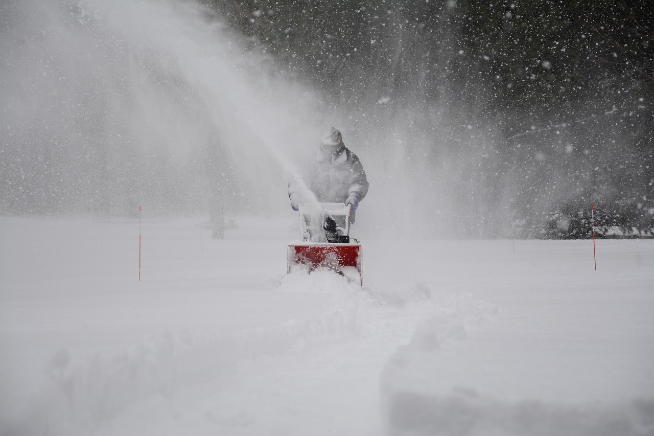
- If you’re in a snowier zone (Northeast, Appalachians, Intermountain West, Pacific Northwest, Alaska): test snow blowers and generators before the first storm, stock ice melt and sand, and confirm your snow removal contract or plow arrangements now rather than after the first storm warning.
- If you’re in the wetter South or Florida: check gutters, drainage, and roof seals ahead of a winter that leans wet rather than freezing, and keep an eye on flood-prone areas during heavier rain events.
- If you travel for winter sports: the Pacific Northwest and Intermountain West stand out as the most likely regions for an above-normal snow season, which is good news for ski trip planning, while the Southeast and Plains lean drier.
- Everywhere: keep a basic winter emergency kit in the car (blankets, flashlight, phone charger, snacks) since even a mild-winter forecast doesn’t rule out a fast-moving storm or cold snap.
Winter costs are also worth budgeting for early. If you’re already tracking other changes taking effect this fall and winter, it’s worth reviewing our guides to the Social Security COLA for 2027, the Medicare Open Enrollment 2027 dates and costs, and ACA Open Enrollment 2027, since all three affect household budgets around the same time the winter heating season ramps up.
Key Dates to Know
- August 27, 2026: The Old Farmer’s Almanac released its full winter 2026-2027 forecast.
- Early September 2026 (around Labor Day): The print edition of the 2027 Old Farmer’s Almanac, with the complete 18-region, week-by-week outlook, becomes available.
- Meteorological winter: December 1, 2026 through February 28, 2027.
- Astronomical winter: December 21, 2026 (winter solstice) through March 20, 2027.
- NOAA’s official winter outlook: The Climate Prediction Center updates its December-January-February seasonal outlook monthly, with the most detailed version typically issued in November.
Frequently Asked Questions
Will winter 2026-2027 be cold or mild in the U.S.?
Mostly mild. The Old Farmer’s Almanac forecasts near-to-above-normal temperatures for most of the country, with a below-normal exception running from central New England through the Appalachians and Ohio Valley, plus an unusual cold pocket in Hawaii.
Which states will get the most snow in winter 2026-2027?
The Almanac points to above-normal snowfall in parts of the Northeast and Appalachians, the Intermountain West, the Pacific Northwest, and Alaska. The Southeast, Plains, and Desert Southwest are expected to see below-normal snow.
Is the Old Farmer’s Almanac forecast the same as the Farmers’ Almanac forecast?
No. They’re separate publications with different proprietary methods. For winter 2026-2027, the Farmers’ Almanac calls for a more active southern storm track with sharper cold-and-snow bursts in the North, while the Old Farmer’s Almanac leans toward an overall milder winter with a defined cold corridor in the East.
Does NOAA agree with the Old Farmer’s Almanac?
Broadly, yes, on the big picture. NOAA’s Climate Prediction Center also favors above-normal to near-normal temperatures for most of the U.S. this winter, along with above-average precipitation for the Southwest, Central, South, mid-Atlantic, and Northeast, which lines up reasonably well with the Almanac’s wetter-West-and-South theme.
What role does El Niño play in this year’s forecast?
El Niño, the warm phase of the El Niño Southern Oscillation, is one of the main climate signals behind this year’s outlook. It’s historically linked to milder winters across much of the northern U.S. and wetter conditions in the West and South, tendencies reflected in both the Almanac’s and NOAA’s 2026-2027 outlooks.
How accurate is the Old Farmer’s Almanac’s winter forecast historically?
The Almanac claims roughly 80% accuracy using its own scoring method, but independent verification attempts have generally found accuracy closer to chance, especially at the regional level. Treat it as a general planning guide rather than a precise forecast, and rely on NOAA or your local National Weather Service office for shorter-range detail.
When does the Old Farmer’s Almanac release its winter forecast each year?
The Almanac typically previews its winter outlook in late August, with the full 2027 edition, including the detailed 18-region, week-by-week forecast, arriving in print around Labor Day.
Will this winter be as bad as the January 2026 winter storm?
Not likely on a seasonal average basis, since the Almanac calls for a milder winter overall in 2026-2027. However, the same cold corridor from central New England through the Appalachians and Ohio Valley is flagged again this year, and forecasters warn that short, sharp cold outbreaks remain possible if the polar vortex weakens, even within an otherwise mild season.
Bottom Line
The Old Farmer’s Almanac’s winter forecast 2026-2027 points to a generally mild season for the United States, with a clear cold corridor from central New England through the Appalachians and Ohio Valley, wetter conditions across much of the West and South, and above-normal snow favored in the Northeast, Intermountain West, Pacific Northwest, and Alaska. That outlook is broadly consistent with NOAA’s official winter forecast, even if it diverges in places from the rival Farmers’ Almanac. As with any seasonal outlook issued months ahead of time, use it for big-picture planning, budgeting for heating costs, prepping snow gear, and timing winter travel, rather than for pinpointing any single storm.